
Great Pictures of Doi Tung, I visited a few weeks after it was open. It has matured a lot, looks like time for another trip.
Great Thread.
Results 101 to 112 of 112
-
19-02-2008, 04:42 PM #101Thailand Expat


- Join Date
- Jun 2007
- Last Online
- 09-12-2025 @ 04:00 PM
- Location
- Stuck in COVID UK at the moment
- Posts
- 1,870
-
21-02-2008, 04:06 AM #102Member
- Join Date
- Feb 2008
- Last Online
- 03-02-2015 @ 03:39 AM
- Location
- Virginia, USA
- Posts
- 17
Great thread, Terry. Thanks for taking the time to share your pictures. The ones of Doi Tung are amazing.
-
22-02-2008, 12:41 AM #103Thailand Expat

- Join Date
- Nov 2007
- Last Online
- 15-07-2015 @ 01:49 AM
- Location
- Bangkok
- Posts
- 1,529
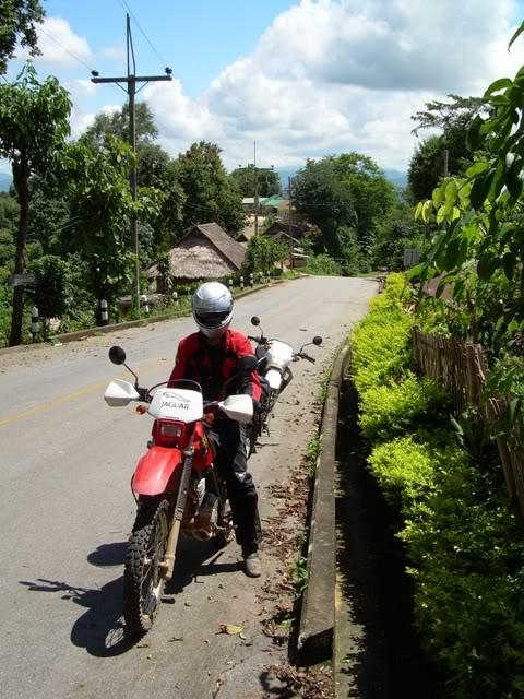
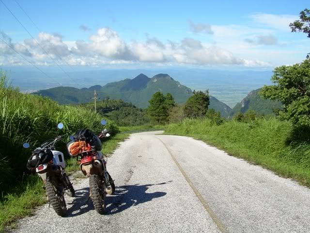
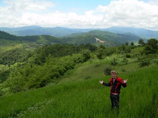
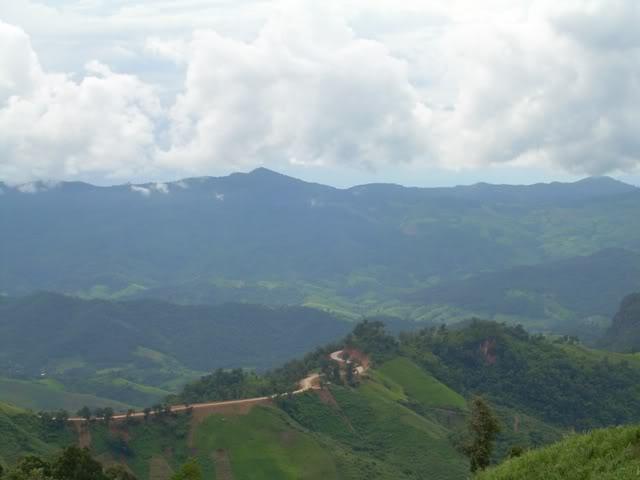
For anyone wanting to do this trip here are a few photos of the Doi Tung section.
One route up to Doi Tung on the Mae Fah Lang road
Temple on the top of Doi Tung

View over Burma from the Doi Tung-Mae Sai mountain road

View over the Golden Triangle from the Doi Tung-Mae Sai mountain road
I have lots more bike trip photos of this region if anyone is interested
-
22-02-2008, 12:44 AM #104Thailand Expat

- Join Date
- Jun 2005
- Last Online
- 08-09-2014 @ 10:43 AM
- Location
- Simian Islands
- Posts
- 34,807
Yes please! Originally Posted by madjbs
-
22-02-2008, 12:48 AM #105Thailand Expat
- Join Date
- Nov 2007
- Last Online
- 15-07-2015 @ 01:49 AM
- Location
- Bangkok
- Posts
- 1,529
I will dig some more out, they aren't as good as terrys mind, so don't expect too much

-
22-02-2008, 01:18 AM #106Thailand Expat
- Join Date
- Nov 2007
- Last Online
- 15-07-2015 @ 01:49 AM
- Location
- Bangkok
- Posts
- 1,529
This section of road is a loop which you can do from Fang and goes up Doi Ang Khang. When we did it it was unfortunately covered in cloud, wet and very cold.
You start by taking route 1249 which joins the 107 about 15km south of Fang
As you wind you way through the valley you get views like this

After a while you start to climb the road up Doi Ang Khang and eventually you come to a rather scary hill tribe village on top of the mountain (I think it is called Ban Luang). I didn't dare get any photos here as some of the local guys didn't seem to take too kindly to our presence! The road splits in 2 here and there is an army checkpoint. If you take the right hand route you can take a very steep and windy gravel/concrete track all the way down into Fang. This is defiantly not a route for low confidence riders, a broken motorbike here could be serious.
Only a couple of pics due to the bad weather and the fact my new to biking mate was having a bit of a freak out. He manage to fall off on the gravel corner and break his clutch lever. Luckily I was able to bodge it so we could get to Fang.


*Note the matching gear")
-
22-02-2008, 01:19 AM #107Thailand Expat

- Join Date
- Aug 2007
- Last Online
- 01-11-2014 @ 09:25 AM
- Location
- Villa Sariano, Phala Beach, Ban Chang, Rayong, Thailand
- Posts
- 3,789
Thanks much Terry for the trip report. Very enjoyable.
-
22-02-2008, 01:42 AM #108Thailand Expat
- Join Date
- Nov 2007
- Last Online
- 15-07-2015 @ 01:49 AM
- Location
- Bangkok
- Posts
- 1,529
Last set of pics for tonight,
This loop is called the Mae Salong loop by GTrider, you take route 1234 which starts from the Fang-Mae Chan road about 20km east of Tha Ton. The road is great for biking and the scenery is excellent. You will see lots of pickups on this route stuffed full of tourists, for extra fun you can look at their horrified faces as you try and overtake them on blind bends etc...
Somewhere along the route
Mae Salong Inn

Great Biking corners

Nice Greenery

Unfortunately I didn't get any pics of Mae Salong village, the village itself is full of tea shops and there is some nice temples. Anyone have any pics?
After Mae Salong you can carry on along route 1234 all the way to Mae Chan or you can do what I did and take a back route to Doi Tung (look at my first post on this thread). This Back route starts 25km further on along route 1234 after Mae Salong.Last edited by madjbs; 22-02-2008 at 01:51 AM.
-
22-02-2008, 02:05 AM #109The Dentist


- Join Date
- Aug 2006
- Last Online
- @
- Location
- Gaslightingshire
- Posts
- 17,807
Cheers Madjbs, nice addition to the thread.
-
22-02-2008, 03:19 PM #110Thailand Expat
- Join Date
- Nov 2007
- Last Online
- 15-07-2015 @ 01:49 AM
- Location
- Bangkok
- Posts
- 1,529
This section is a route between Chiang Khong and Chiang Kham. Take the 1020 south out of Chiang Khong for 16km, here there is a T junction where the 1155 joins. Both roads take you to the same place but to go the interesting route you need to take the 1155. You end up driving along the banks of the Mekong and there is several view points where you can get a snack and look over into Lao. The road here is fantastic for biking, lots of sweeping bends and great views.
You drive along the 1155 for 45km and you will then come to a junction with the 1093. You can go both ways but the 1093 will take you up into the mountains along an easy dirt track through many hill tribe villages, the road goes very close to the border and there is a few checkpoints so take ID. Absolutely do not go along here at night (this also goes for the Mae Sai-Doi Tung mountain road in my first post)as there will be all kinds of dodgy people and packeges crossing and travelling along these roads. It is possible the route will be all paved now as they were in the process of leveling it out when I was there last, anyone know?
Hill tribe village on the 1093

Kids seemed suprised to see us

View back over into Thailand and the 1093
After traveling along this road for about 50 km you come to a village called Rom Pho Tai, there is a checkpoint here and a Y junction. If you are tired go right which will take you back down to the 1155 where you can carry on to Chiang Kham. If you can take more riding go left and carry on along little paved roads for another 35km until you reach the 1021 very near to Chiang Kham.
-
22-02-2008, 03:55 PM #111The Dentist
- Join Date
- Aug 2006
- Last Online
- @
- Location
- Gaslightingshire
- Posts
- 17,807
Great stuff guys, if anyone else has any i think they should be added.
Thanks for sharing.
-
22-02-2008, 04:08 PM #112Revenant Rodent

- Join Date
- Jan 2006
- Last Online
- @
- Location
- Mousehole
- Posts
- 21,054
Great pictures.
Here is a map of the area


 Reply With Quote
Thread Information
Users Browsing this Thread
There are currently 1 users browsing this thread. (0 members and 1 guests)
