

Page Visit Log : bangkok-maps
» Bangkok Maps
Maps of Bangkok
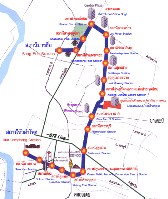
Bangkoks Mass Transit System, the BTS Sky Train and the MRTA Subway is a convenient and cheap way to travel around Bangkok, the stations link up with the major bus/coach stations and the underground links up to Hua Lamphong Train Station.
*edit May 2009*
The BTS now has been extended to Thonburi on the Silom Line, Updated Map.
If you want to learn more about Bangkok or have any questions why not post them on our Bangkok Forum
Hello Unregistered,
Bangkok BTS local area maps Silom Line
These local area maps will give you details of Hotels, Restaurants, Temples, Bars, Shopping Malls and Tourist Attractions in the vicinity of each BTS Station.
Chong Nonsi Map
National Stadium Map
Krung Thonburi Map
Ratchadamri Map
Sala Daeng Map, underground cross over point
Saphan Taksin Map
Siam Map, Sukhumvit Silom cross over point
Surasak Map
Wongwian Yai Map
Bangkok BTS local area maps Sukhumvit Line
Ari MapAsoke Map
Chitlom Map
Ekkamai Map
Mochit Map
Nana Map
Phaya Thai Map
Phloen Chit Map
Phra Khanong Map
Phrom Phong Map
Ratchathewi Map
Siam Map, Sukhumvit Silom cross over point
Sanam Pao Map
Saphan Khwai Map
Thong Lor Map
Victory Monument Map
BTS and MRTA Map

Bangkok Basic Map

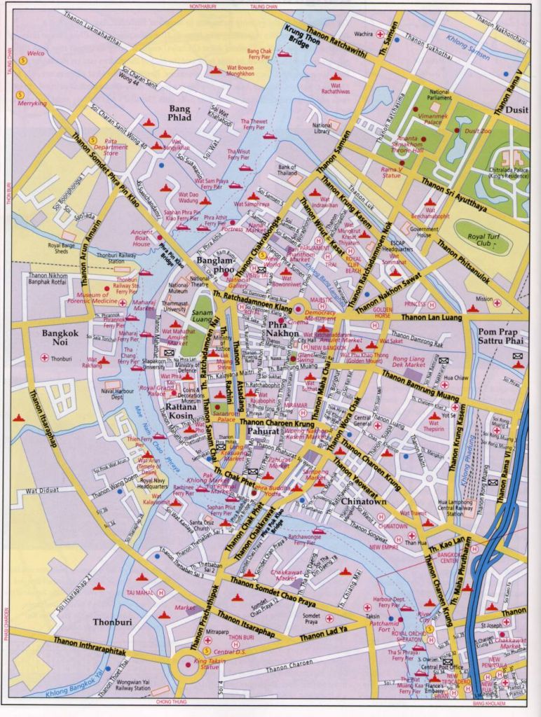
Bangkok Detailed Street Map
Bangkok Interactive Map
View Larger Map